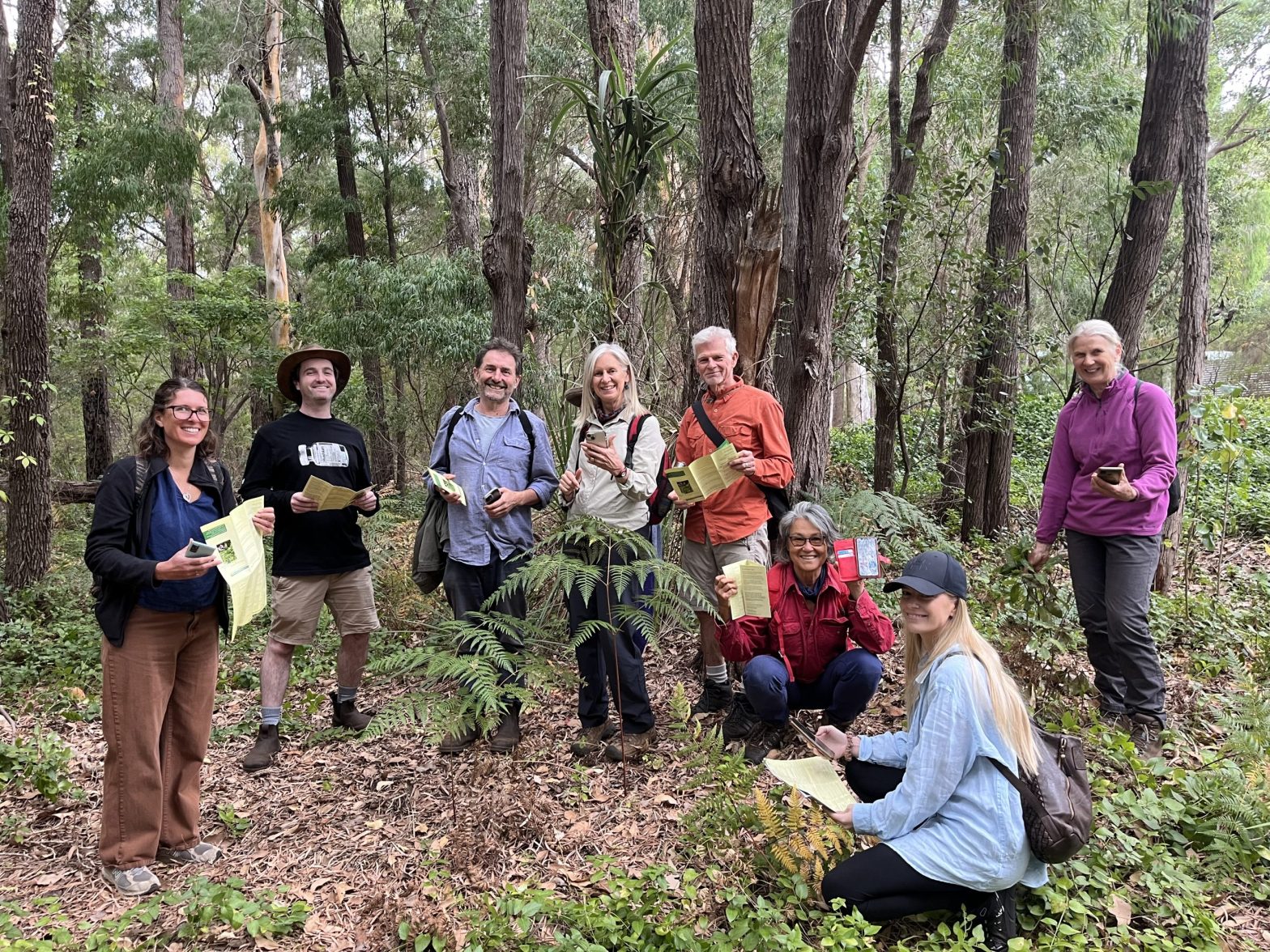
Locals take lesson on Fieldbook app
A total of 15 weed species can be reported, including arum lilies and all the highest priority non-native weedy weed trees that are a major conservation concern across the Margaret River region. Image supplied.


Volunteers had a masterclass in weed mapping to help boost bush and biodiversity at Nature Conservation Margaret River Region’s latest monthly Friends of Wooditjup Bilya event.
A small army of volunteers learned how to use Nature Conservation’s citizen science weed mapping app, called Fieldbook.
Anyone can download the free Fieldbook mobile phone app, which allows people to record target invasive weed species they see in any area of bushland, national park, road verge or reserve in the region.
The information collated by Nature Conservation is being shared with community groups and government departments to help map infestations and identify priority areas.
Weed mapping is also important to identify the extent of weed infestations, and zero in on threats to high priority areas.
Since launching the app last May, more than 11,000 individual weed records have been submitted by more than 50 regular users in the community.
And already maps generated using the data collected by volunteers are being used to direct arum lily control efforts in a more strategic way.
This Friends of Wooditjup Bilya event coordinator Jodie Passmore said many locals are “starting to look on their properties and beyond their boundaries to act as custodians of the Wooditjup Bilya or Margaret River”.
“At this session, we learned the key weed species which threaten the biodiversity of Wooditjup Bilya, how to identify them, map them, and what we can do to control them to protect our river,” she said.
Nature Conservation biodiversity officer Obelia Walker, who ran the workshop, said some of the priority weeds found along the river include sweet pittosporum, asparagus fern, blackberry, periwinkle and polygala.
“These weeds can all be reported on the Fieldbook app, so it’s a great excuse to head out for a walk in your local bushland or along a stretch of the river and map these weeds,” she said.
Obelia urged anyone with an interest in nature to get involved, because there are gaps in the data that Nature Conservation is hoping to fill.
“If safe to do so, we are seeking weed data on roadsides as these areas are often a hot spot for weeds, acting as a seed source to adjoining land.
“We are also hoping to engage more people in Dunsborough, Busselton and Augusta to download the app, helping to extend our mapping efforts and build a more comprehensive picture of weed presence and extent across the region.”
The data collected from the app will also help Nature Conservation fight for funding and resources to do more in the conservation space.
“Plus, it will help us argue the case for environmental weed control on public land and lobby government departments to take responsibility.
“And it will provide these organisations with a valuable resource for priority setting and monitoring,” Ms Walker said.
“It’ll also help with discussions with politicians and decision-makers. With our environment facing threats on all fronts and climate change starting to take a toll, there has never been a more important time to get involved with local, hands-on conservation like downloading this app, learning to identify weedy species, and uploading the info via the app.”
For more detail including instructions on how to download and use the app, see www.natureconservation.org.au/weed-mapping
Share


Related Articles

How Busselton Graduates Can Stand Out in a Competitive Job Market
Graduating from university is always an exciting milestone. However, entering…
Kids race added to Cape to Cape
Cape to Cape MTB, Australia’s largest and most popular mountain bike…