Surprising results at iconic Lake Cave after devastating bushfire
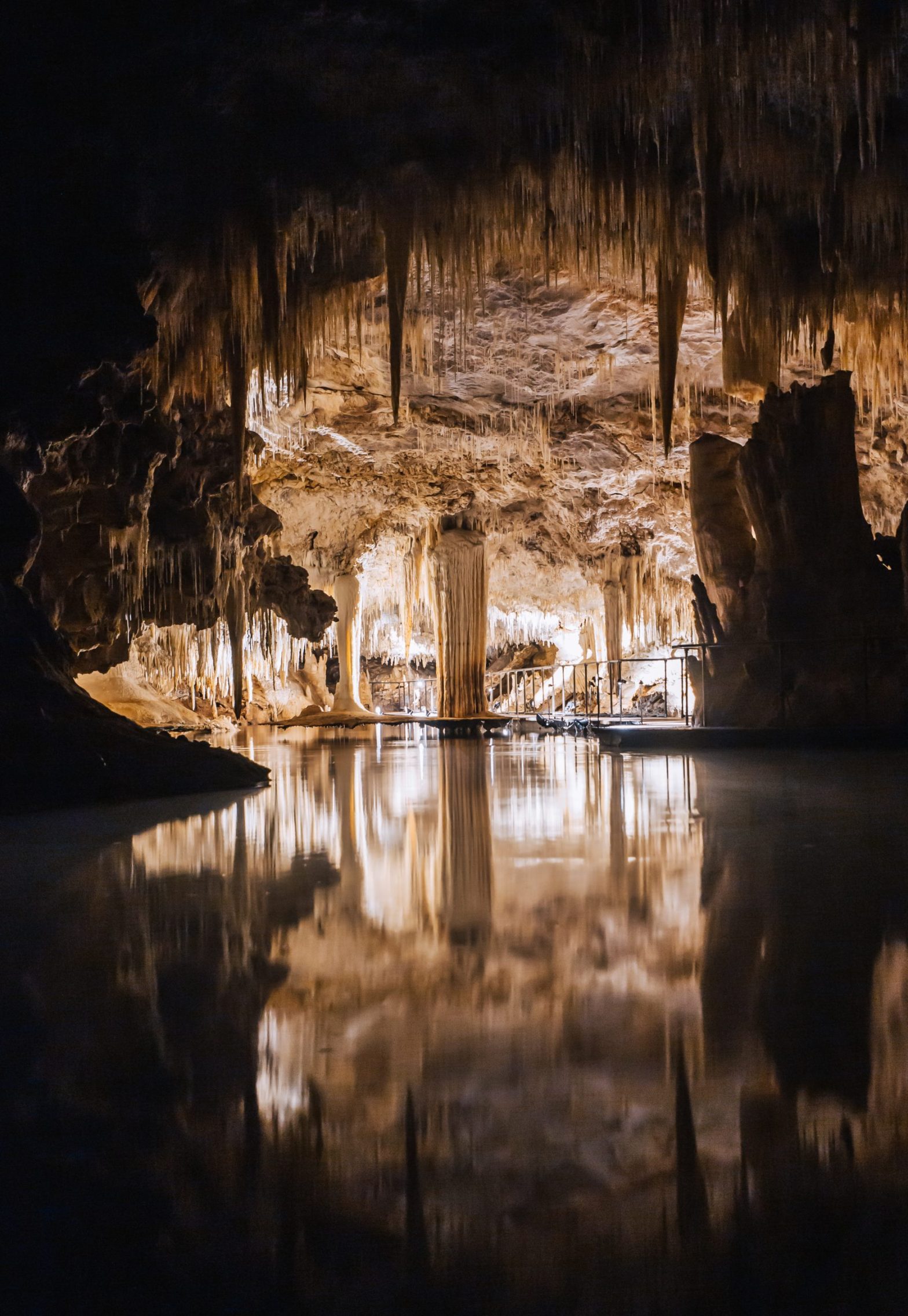
Water levels in Margaret River's famed Lake Cave have reached their highest point in decades. Picture: Holly Winkle


A surprising impact of the devastating 2021 Calgardup bush fire is being seen in one of Margaret River’s most precious natural tourist attractions.
Water levels in Margaret River’s famed Lake Cave have reached their highest point in decades, after the fire burnt significant areas of vegetation, which would normally absorb large amounts of water from the soil.
As Capes Foundation Director Steve Harrison explained, this allowed a greater amount of rainwater to permeate the limestone ridge, allowing the water levels in the cave to rise.
Capes Foundation have been studying the water levels in Lake Cave for more than 15 years through their Lake Cave Hydrology Project, which has recorded the fluctuations in water levels in response to changing vegetation.

“The water in the cave’s lake originated as rainfall on flat ground about 1 or 2 km to the east,” Mr Harrison said.
“It is now making its way through the limestone ridge towards the coast, where it emerges as springs, including the one at Conto Spring Beach.
“During the summer of 2021/22 a large bush fire burnt much of the surrounding vegetation which would naturally draw up a lot of the soil water.
“As a result, a larger quantity of water is now flowing through the limestone, leading to an elevation in the water table within the porous rock.

“This event clearly demonstrates the interconnected nature of our environment and how changes in above ground vegetation impact the water levels below ground.”
The Foundation urged locals and visitors to the region to take the opportunity to see Lake Cave in what it called “what might be a ‘once in a lifetime’ experience” at the iconic cave.
Share


Related Articles

How Busselton Graduates Can Stand Out in a Competitive Job Market
Graduating from university is always an exciting milestone. However, entering…
Kids race added to Cape to Cape
Cape to Cape MTB, Australia’s largest and most popular mountain bike…